What is your idea of a dream holiday? For my wife and I, it was to walk the Cami de Cavalls, a long-distance footpath that circumnavigates the island of Menorca, in the Balearic Isles. It is 115 miles long, but with detours and extras, we walked a total of 130 miles in 13 days in April 2018. We did not hump tent and pegs, however - we booked the holiday with a firm that arranged the itinerary and accommodation, and transported our luggage (and us if necessary), from stage to stage. As it was out of season, we stayed in a range of places, from naff through comfortable to jaw-droppingly luxurious. Menorca is a beautiful island, with many types of scenery, fine bird-watching and 3,000 years of historical remains to explore. In this article, I will use a selection of my holiday snaps to tell the story of our walk, and the (natural) history of the island. Perhaps it will encourage you to don your walking boots and explore Menorca for yourselves. And if not…well, we walked around Menorca so you don’t have to.
The Cami de Cavalls is divided into twenty stages. It is 115 miles in total. The circumnavigation begins in Menorca's capital Mahon (Mao in Catalan) in the east of the island and proceeds anticlockwise around the wind-swept north to Ciutadella, its second city on the west coast, then hugs the southern coast, where most of the modern tourist-focused urbanisations are sited and back to Mahon.
Our itinerary (complete with annotations) took us around the whole of the Cami de Cavalls in thirteen days. As the north of the island is relatively unpopulated (and it was out of the holiday season, which begins promptly on 1st May), we spent up to three nights in some hotels, being taken by minibus to and from the start and finish points of the day's walk. In the south, we could more or less walk from hotel to hotel.
Our trip began in Mahon (Mao), the capital of Menorca since the eighteenth century. Like most Mediterranean islands, Menorca has had a succession of rulers: Carthaginians, Romans, Byzantines, Moors, Andalusians, British, French (briefly) and finally Spanish. The British ruled Menorca from 1713 to 1802, with a couple of breaks during European wars when it was briefly captured by France. It was the British who moved the capital from Ciutadella to Mahon. The attraction was the harbour (apparently the largest deep water harbour in the world, after Pearl Harbour).
Mahon remains a small town, sleepy out of season - and during the siesta hours, which the locals take very seriously.
The British influence can still be seen in the old town, where many buildings retain sash windows. Menorca was captured from the British by France in 1756, during the Seven Years War, to public outrage in Britain. Admiral John Byng, whose role it was to defend the island was court martialled and executed by firing squad, leading to Voltaire's lugubrious comment that in Britain, 'it is good to kill an admiral from time to time, in order to encourage the others’. Britain regained control of Menorca in 1763.
The first day's walking was the only one under cloudy skies. The Cami de Cavalls is very well marked, with posts every twenty yards or so and regular distance signs. We passed through many Menorcan gates, made to a traditional design out of wild olive wood. Menorca is not a mountainous island, but the path was almost continually undulating, up onto cliffs and down to coves and bays, so we put in many yards of ascent over its course.
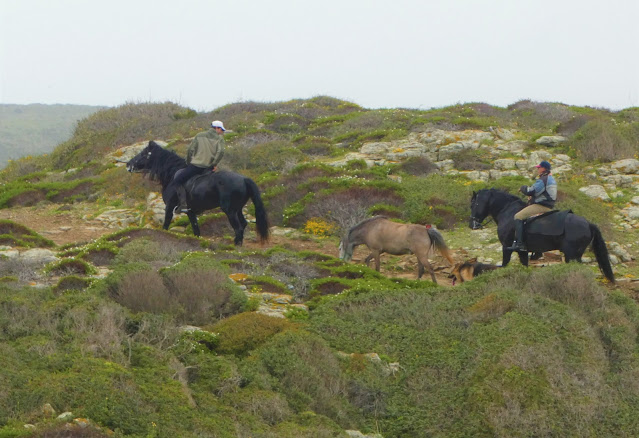
Cami de Cavalls means 'Way of the Horses', and the modern footpath is based on a Medieval route that was part of the island's defenses against invasion and piracy. Menorquin pedigree horses are superb creatures that play in role in the island's traditional festivals.
The north of Menorca is not intensively farmed and in spring, the fields are filled by swathes of wild flowers.
Flowers are particularly prevalent near the path itself, due to years of fertilisation by passing horses.
We also passed many traditional Menorcan wells.
The north of the island is made of strata of ancient sandstones, and can be battered by northern winds. These contribute to the formation of 'socarells', low spiky bushes that look like hedgehogs.
The main point of interest during the first day was Parc Natural de s'Albufera des Grau, an extensive wild bird reserve. Unfortunately it was the wrong time of the year to see the flocks of waterfowl that use it, but we saw many species of birds as the walk went on.
Menorca is scattered with military remains, reflecting its place in a succession of European conflicts. This is Torre de la Mesquita, built by the British during the Napoleonic Wars.
Evidence of past industry in the north of Menorca. The Salines de Mongoira are former salt workings...
...They now abound with birdlife, with black-winged stilts a particular feature.
Basilia des Cap des Port is the remains of a 6th century Christian chapel.
Another 19th century saltpans, Salinas de la Conceptio, is currently being restored.
Sanisera Roman fort dates from the 2nd century B.C. At that time, there was a considerable Roman town in the area, following the Roman conquest of Menorca in 123 B.C.
Platja de Cavalleria is the most picturesque beach in the north of Menorca.
Another feature of Menorca are these dry-stone animal shelters, dating from the 19th century or earlier. We passed many in the north and west of the island
Following a day of steep ascents and descents...
...we spent the night at Son Felipe, a working farm that also offered luxury accommodation. I'm sure we were only booked there as it was out of season!
The owners of the farm also bred Minorquin horses.
Dragging ourselves back onto the path, we passed more evidence of 19th century industry, in the form of an abandoned copper mine shaft.
Many of Menorca's bays have bunkers built into the cliffs, as here at Cala d'Algerains. They date from the Spanish civil war in the 1930s. During the war, Menorca was staunchly Republican, and the islanders, living under constant expectation of invasion by Franco's Nationalist forces, built these bunkers as means of civil defense. In the event, Menorca was not invaded until 1939, and major loss of life was averted by the British brokering the island's surrender, which took place on board H.M.S. Devonshire, in Mahon harbour.
The tourist industry developed later on Menorca than on the other Balearic islands, and it is said that following the civil war, Franco starved the island of state funds for tourism as punishment for the island's support of the Republican government. This does, however, contribute to the island's relatively unspoiled appearance.
As well as bunkers, dwellings were built into the cliffs in places, such as these fishermen's huts near the town of Cala Morell...
...where we also saw an extensive rock-carved necropolis, used for interments during the 'Talayotic Period' (covered later), from the late Bronze Age, through the Iron Age and finally abandoned around 200 A.D.
From the north west of the island, and covering the whole of its southern half, the underlying terrain changes from sandstones to hard, more easily workable limestone. The section of the walk from Cala Morell to Ciutadella was relatively flat, but rocky and exposed, with scant vegetation. It is criss-crossed with dry stone walls, with many stone wells and animal shelters. In the past, the land was used for grazing cattle.
Port d'en Gill is a photogenic landscape feature.
Ciutadella was Menorca's capital prior to the British occupancy and it has a more Spanish flavour than Mahon. It contains the island's cathedral (in the top left-hand corner of this picture), and landowners' town houses and monasteries that date back to the 17th century or earlier.
The Castell de San Nicholau is a 17th century fortress built to protect the harbour.
On a Sunday evening, the town's 19th century market is a meeting place for locals.
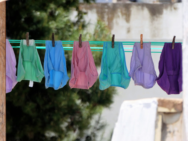
Life in Ciutadella is pants.
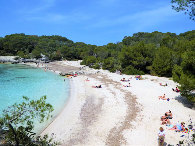
The southern coast of Menorca is sheltered from the prevailing winds and has a higher proportion of resorts, bathing beaches and urbanisations. We walked through several of the latter, and did not enjoy the monotony of the rows of modern, whitewashed apartments and the main streets filled with cheap restaurants, that out of season looked like abandoned film sets. Out of the way bays such as Cala Macarella were more appealing...
...and were well patronised by locals.
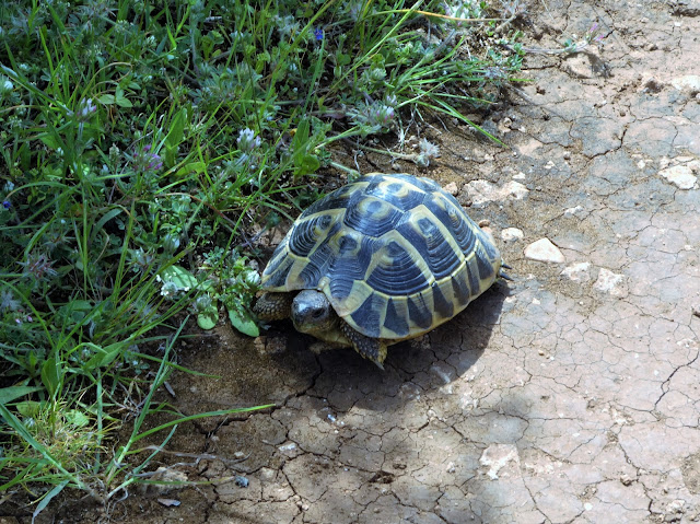
As tortoise owners, we were thrilled to see a wild tortoise by the side of the path.
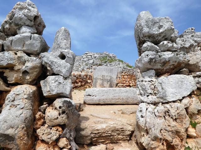
The south of the island is the setting for many of Menorca's prehistoric sites, particularly those from the so-called 'Talyotic culture' that prevailed from the late Bronze Age (around 1000 B.C.) to the time of the Roman occupation in 123 B.C. The name derives from the 'Talyots' that are dotted around the island, such as this one at Binicodrell (you can just see another on the horizon on the right hand side of the picture). Talyots are truncated, dry-stone towers, built to a range of styles between 900 and 700 B.C. Their specific purposes are unknown, but they were likely built to provide a focus for a local community and may have reflected local power structures.
Later in the Iron Age, small 'villages' of dwellings and other dry-stone buildings were established. One of the best preserved is at Torre d'en Calmes. In addition to Talyots, visitors can explore round houses such as this one, with rooms surrounding a central courtyard. The Necropolis at Cala Morell, that we visited earlier in the walk, was in use during the Talyotic period.
Dwellings are often accompanied by 'hypostyle halls' with stone roofs, that were likely used for storage.
Another feature is the 'Taula Enclosure', a ritual building comprising a circular space with a 'Taula' in the centre. Originally the large horizontal stone would have been placed on top of the standing stone...
...like this restored example, that we saw further along the walk at Binisafullet.
The final day's walking took us along the flat south-eastern coast...
...through the peaceful former fishing village of Alcalter...
...past the last fortress of the walk, Fort Marlborough (18th century British, and best seen from the air)...
..and back to Mahon, as sleepy as we left it.
By coincidence there was a concert in Mahon the day after our return by American jazz bassist Kyle Eastwood...
...does he look at all familiar? Yes, he's son of Clint!
We walked round that!


